In mid 2021, we found one small reminder of the original dray track to the Mount Bischoff mine. It was the faint, but definite, remains of an old bridge, just the approaches, a rotten beam and a few small pieces of timber driven with big iron spikes. We were pretty excited considering is age. It had been abandoned 150 years ago.
The track started as the rough route that James ‘Philosopher’ Smith had made between Knole Plain and Mount Bischoff in 1871 when he famously discovered rich tin ore. He blazed a path that was soon opened up for dray carts and pack horses.[1] From 1872 to 1875, it was the essential link for the emerging mine. Supplies were carried in and tin ore taken out. The track was rough and boggy. It couldn’t take the volume of heavily laden carts and it was soon replaced by the now familiar approach to Waratah.[2]
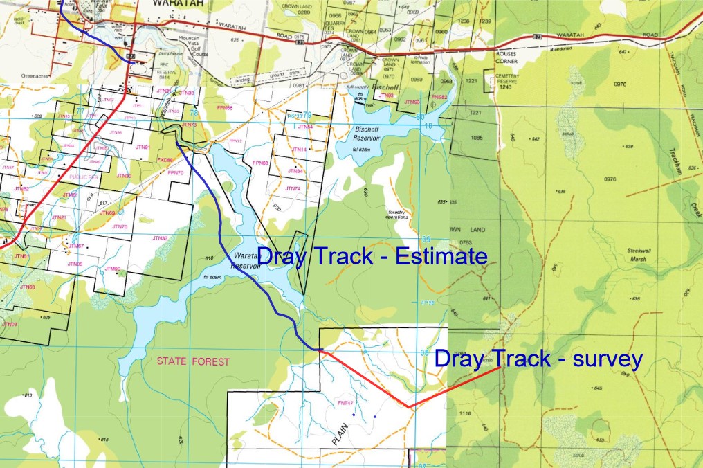
We also found that the lowered waters of the Waratah Reservoir had exposed a well-preserved timber tramway bridge. Not something that we were looking for but it added to the history of the area. You can read the story here. [3]
The reservoir is fully drained
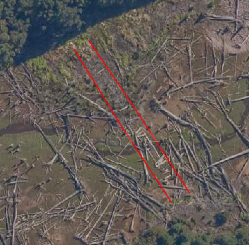
Recently, Tim Jetson, historian and walking companion, alerted us to a new series of aerial photos that captured a completely emptied reservoir. Could more history be revealed?
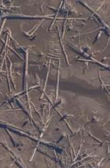
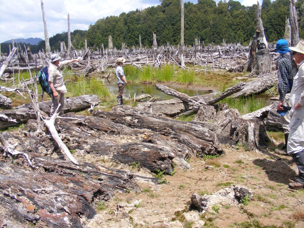
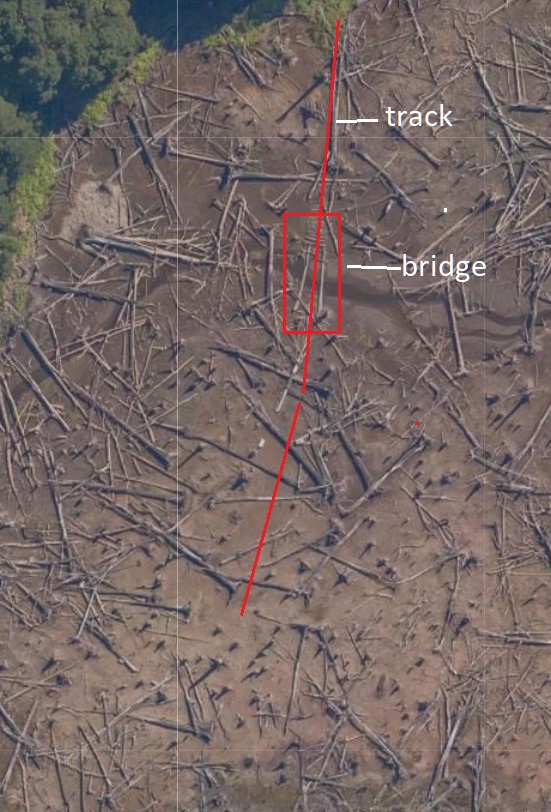
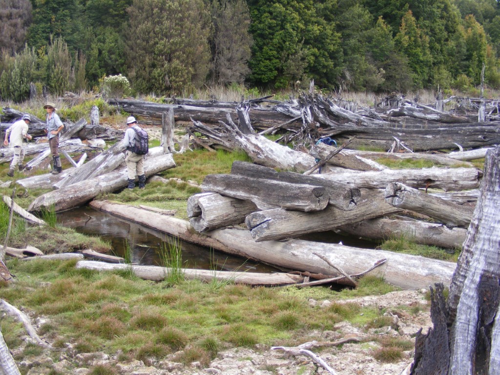
At first glance, the aerial photos only showed mud and the scattered remains of a drowned forest. The bleached stumps and logs made a chaotic mess on the old dam floor. But there appeared to be a little bit of order when we looked closely at where we thought that the dray track had run. It looked like two bridge beams and some cording. The only way to be sure was to go back to the dam. The team; Ian, Nic, Eddie, Jenny, and Tim and I; headed to Waratah.
Mud and dead timber
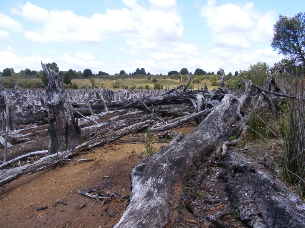
We walked across the decommissioned dam wall and along the old waterline. We ducked around stumps, logs and boggy mud to avoid the worst. Nearing our search area, we spread out a little. Then a cry. We all heeded the call. It was two big timber logs spanning a stream and heavy cording leading to them. Just as the aerial photo captured. It was time to explore in detail.
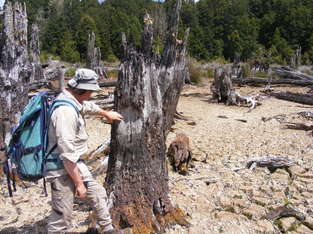
Our problem was there was so much wooden debris but would any of it be part of the dray track? We were looking for any hint; a blaze, logs and stumps with the characteristic signs of axe or saw, cording or a rut worn in the ground. There were bits here and there. We gathered a lot of clues. Now to make sense of it.
On the old northern waterline, a small ridge appeared to lead directly toward the bridge. It was either a natural or formed embankment that the track exploited.
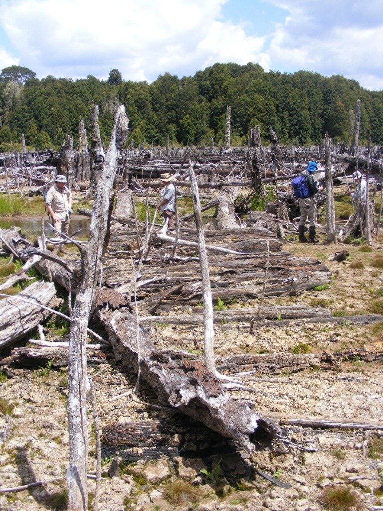
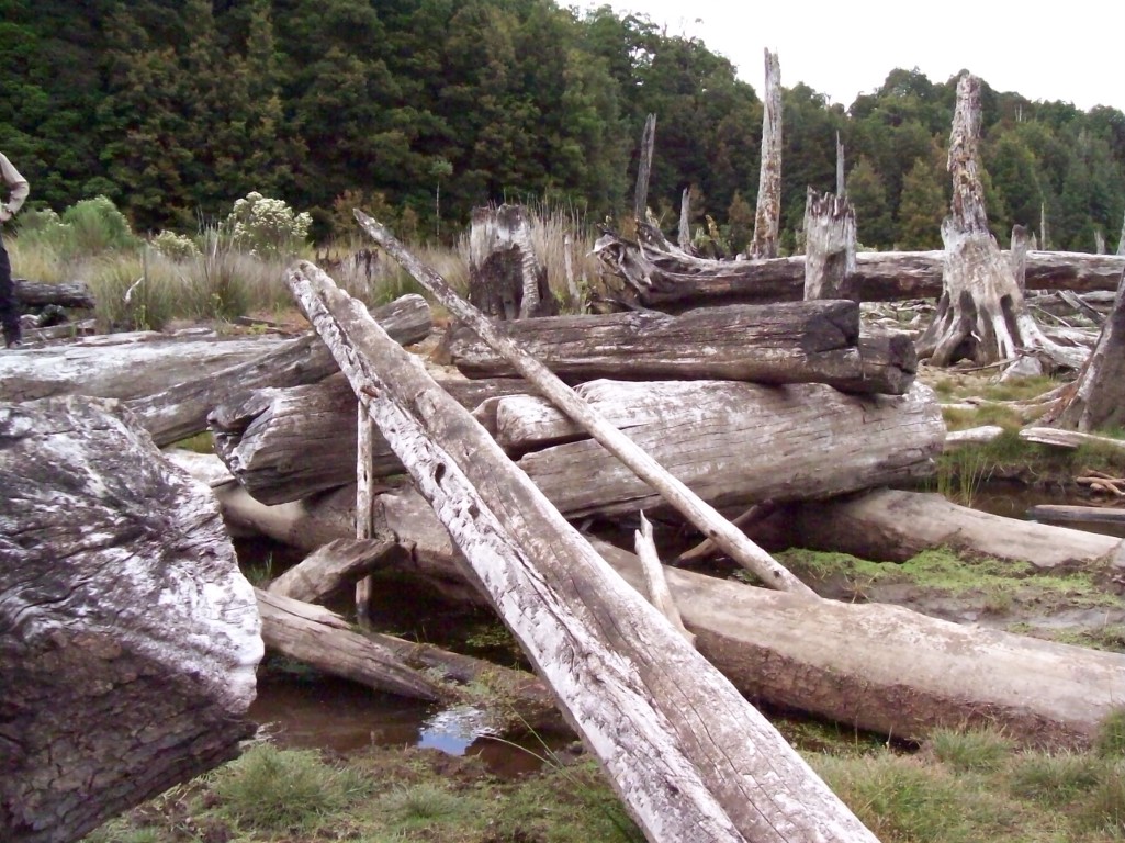
The cording, logs laid side by side, was bigger than any that we had seen before. It was meant for the heavily loaded drays crossing soft ground near the creek.
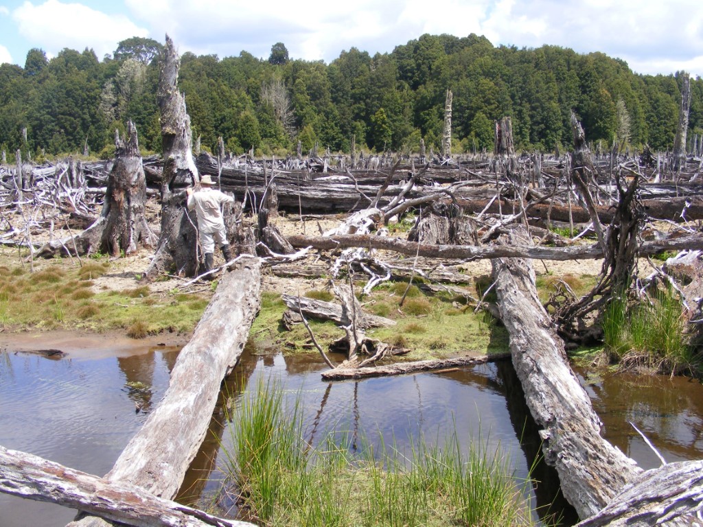
The beams of the bridge remained but the decking had gone. The track ran directly towards the tall dead tree in the distance near the forest. In the photo, Eddie stands near the end of the left beam looking at a blaze on a stump.
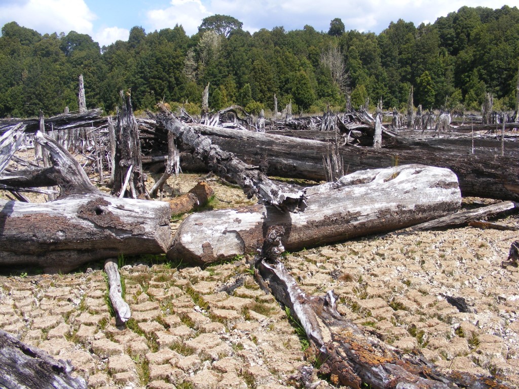
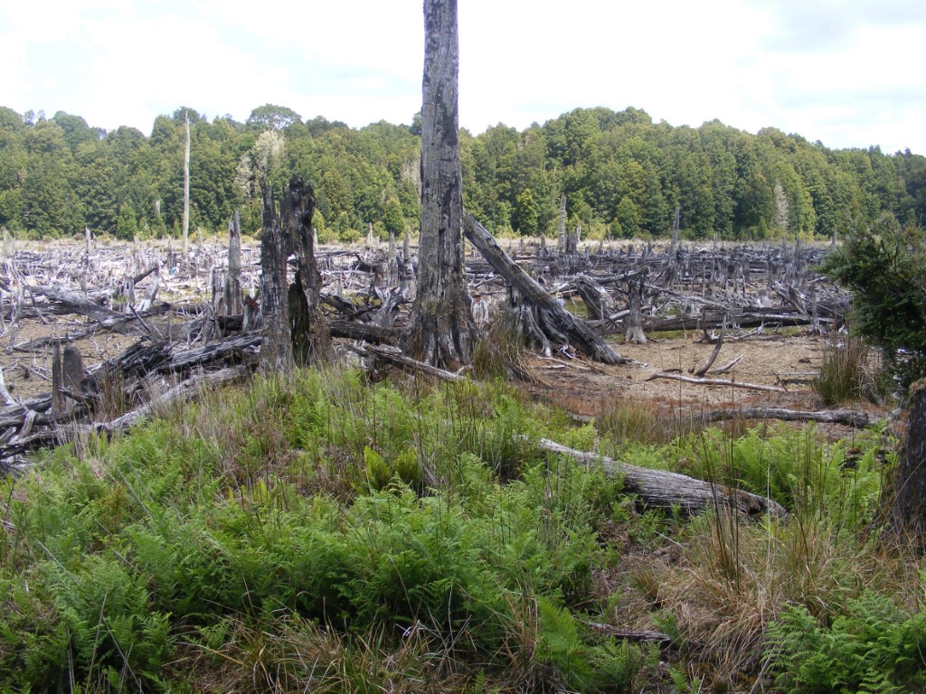
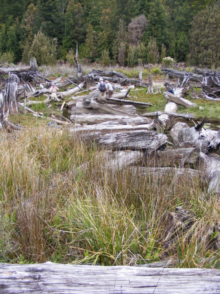
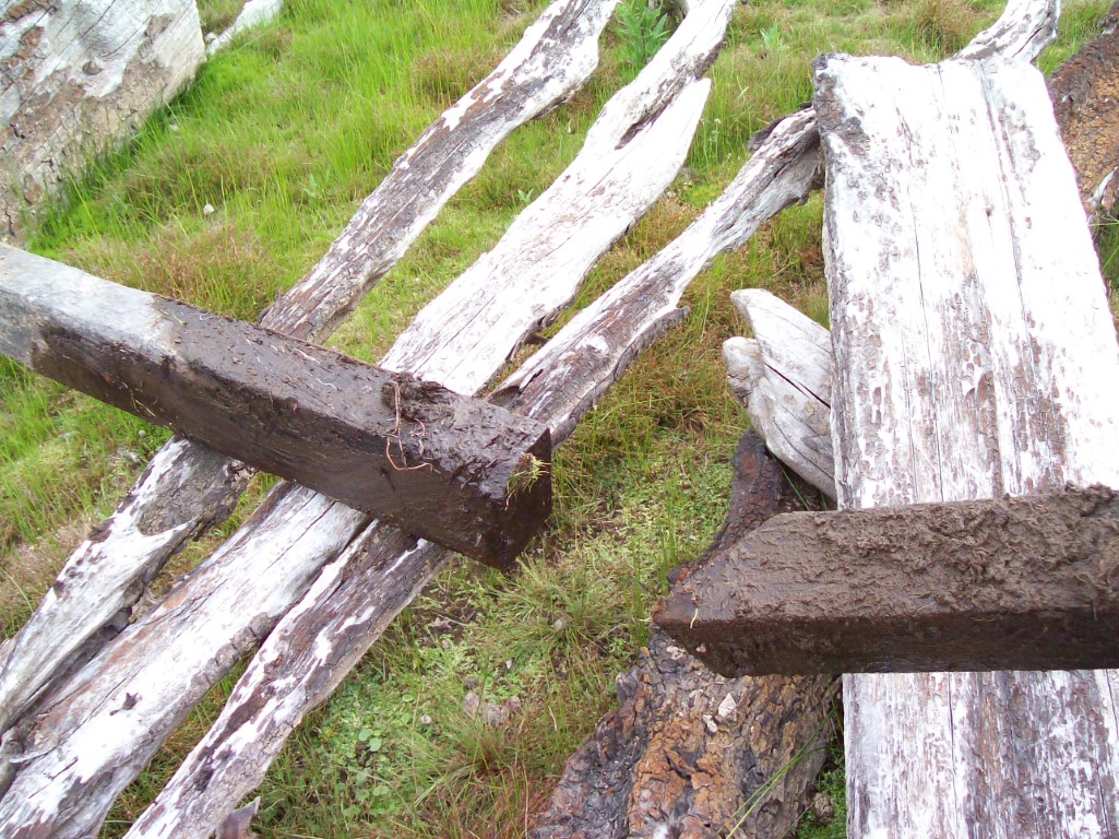
On the south side of the bridge lies a long straight depression, a rut worn by hooves and wheels. The corridor of the rut had been cleared completely of timber and stumps. Although it was now littered with logs that had floated there after the dam was filled. Some of the stumps beside the rut had large blazes. A few logs had been cleared off the line of the track. They had the distinctive pointed ends made by an axe.
Further south we lost the line in the maze of logs. We left the old dam and looked in the forest but without success. The final stop would be to see if the tramway bridge, upstream to the west, had more to show.
Tramway Bridge
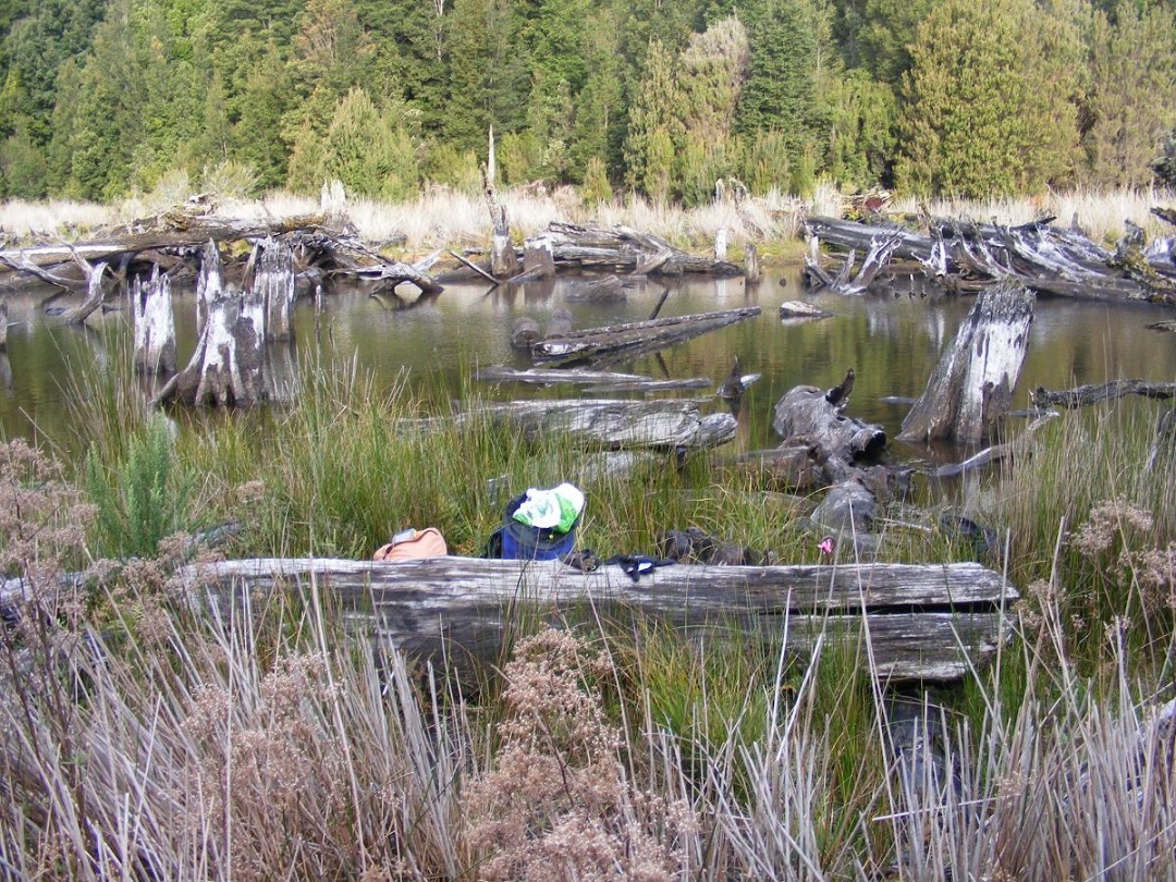
The receded water had revealed much more of the bridge. Again we had a good look around.
It took a while to work out how the bridge was made. The layout is sketched below. The shaded parts in the sketch are those that were located in place or slightly displaced. The dotted shapes are those that were not located at the time, but a number of dressed logs were near the line of the bridge. Another visit would reveal more detail.
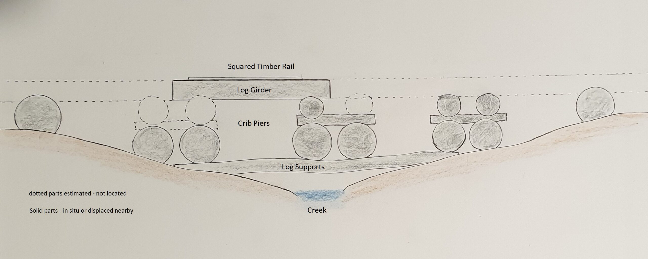
It was a simple beam bridge with a long girder for the tram tracks supported by piers and logs. The closely spaced piers and the size of the logs show that it was built for a heavy load. The support for the central pier was inventive. It was built on two log beams or sills.
The piers were three levels of crossed logs, called a crib or pigsty. The crib piers were a very simple way of building strong supports. Just as they are in mining for holding up the roof of large excavated spaces. The idea may have come from the background of the miners rather than the timber getters. Single supporting logs were spaced evenly along the approaches to the bridge.
Two lines of logs, girders, had been put across the top of the crib piers and the other supports. They were displaced from the original position but we found one nearby.
A neatly squared wooden beam was firmly attached to the girder. We found more around the bridge. These were wooden rails to guide the trams. Previously we had found rotted wooden rails in the forest. Those on the bridge were in almost new condition.
The tramway bridge now made a lot more sense. It was another good day.
The return to the old Waratah Reservoir was remarkable. We had located a significant part of the dray track and more of the tramway bridge. Normally artifacts like these decay to almost nothing over these long spans of time. As had the first dray track bridge that we had found in 2021. The fragility of the dray track was also shown by its complete disappearance in the forests around the reservoir.
There cannot be many wooden structures of this kind that have survived anywhere in the state. To be so well preserved was extraordinary. The drowning of the bridges by the reservoir was a very lucky event that saved them. However, it took the draining of the dam to reveal their wonderful condition. But they won’t last long now that they are exposed to the elements again.
We gained insights into how the dray track and the tramway bridges were constructed and that has shown us the remarkable achievements of people who made and used them a century and a half ago. We were fortunate to see them, privileged to interpret them and pleased to record them for others.
Copyright Peter Brown 2023
[1] RE Smith, The discovery of the Mt Bischoff Mineral Resources Tasmania – compiled by R.E. Smith from notes left by the late James Smith, 11 Jul 1922, Mineral Resources Tasmania, URMISC_1922
[2] Nic Haygarth – https://nichaygarth.com/index.php/2020/10/17/bog-lane-and-the-bullock-graveyard-of-the-bischoff-road/
[3] https://mountainstories.net.au/blog/following-the-philosopher-the-mount-bischoff-dray-road/
[4] Department of Natural Resources and Environment Tasmania.
Waratah is becoming something of a tourist destination. This rediscovery merits some on-site recording of the track and its history. Congratulations to you and the team, Peter, for revealing it once more.
Thanks Rob
Great story. My family spent many happy holiday periods camped at the reservoir. It was our return to the ground of our ancestors, though we didn’t appreciate it as much when we were younger. My grandfather Betts, who died aged 97 in 1952 just a few months before I was born, cut the original track from Waratah to Corinna, and what’s left of the track still bears his name.
Dennis Betts
Thanks for your interesting history Dennis
Thank you so much
Wow isn’t that history so great for thee area?