In January 2016 Simon Cubit published a blog about the hunt for Parsons Hut. In March, and another two blogs later, the hut site had been found. It was a very rewarding search and seemed to be over quickly. The story behind the blogs is that it was much longer and much more difficult that it appeared.
Ian Hayes went into the bush near Lake Mackenzie 12 times and each time couldn’t locate the hut. It was only the dying minutes of the 13th search brought success. I couldn’t go with Ian on his many trips but we developed a collaboration where I did a lot of research and had many long chats with Ian about options, ideas and wild guesses. All this was driven by Ian’s great dedication to getting a result.
How the Search Started
The hunt started with a tantalising mystery. John Pithouse published a book about the pioneering Mole Creek Parsons family Beyond the Sandstone in 2015. It is great reading. The Parsons family were woven through the history of the high country around Mole Creek; prospecting, guiding, fishing, building huts, tourism, hunting and farming.
Ian devoured the book and was struck by a picture of a log hut and the challenge; ‘the exact location of the original log cabin is still undetermined, and subject to conjecture. If anyone reading this has any information in this regard, please pass it on’.1 Although someone may have been getting close because the book also said that ‘the possible location of this unique log hut was re-discovered by analysing the photograph and the description given in the 1902 Weekly Courier story’.2
The hunt started in June 2015. Ian told Simon Cubit that he
was intrigued by the scale of the building (in the photo) and surprised that I had no previous knowledge of it despite having been involved in the Mountain Huts Preservation Society since its beginnings. … I decided I was going to find this hut and was keen to get started.3
The hut had slipped out of the oral history of the area. But John’s book and its reprint of the story brought it back from the long-forgotten past.4
What was Parsons Hut?
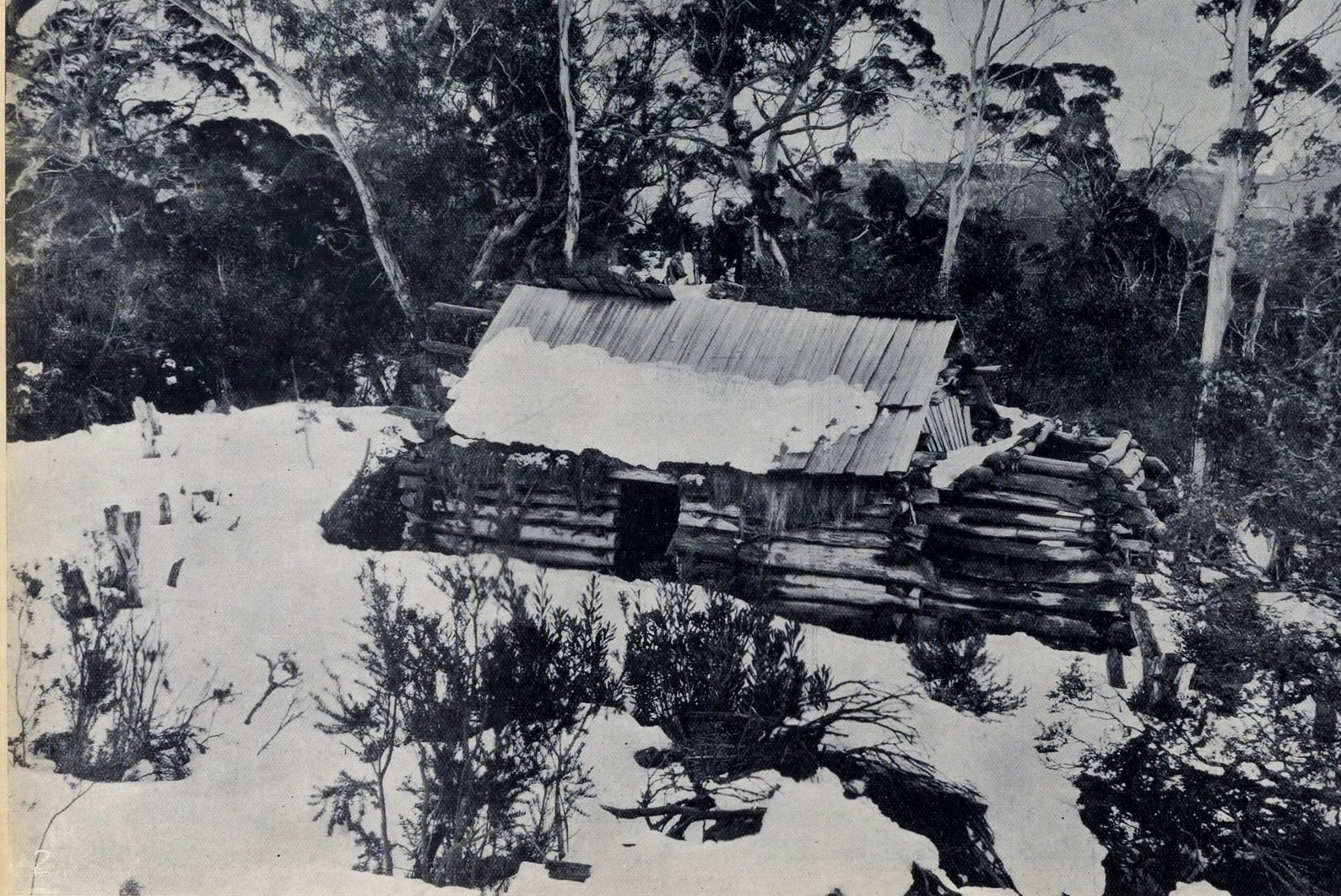
The only source of information about Parsons Hut was a story written by Stephen Spurling in the Weekly Courier in 1904.5 There was a photo of the hut and a just a couple of lines about it. Spurling and his group followed tracks made by a member of the Parsons family ‘and came upon a log hut they had built some years before for use when hunting upon the Tiers. We found it a typical hunter’s camp, rough looking without, and cosy within’.
Where was Parsons Hut?
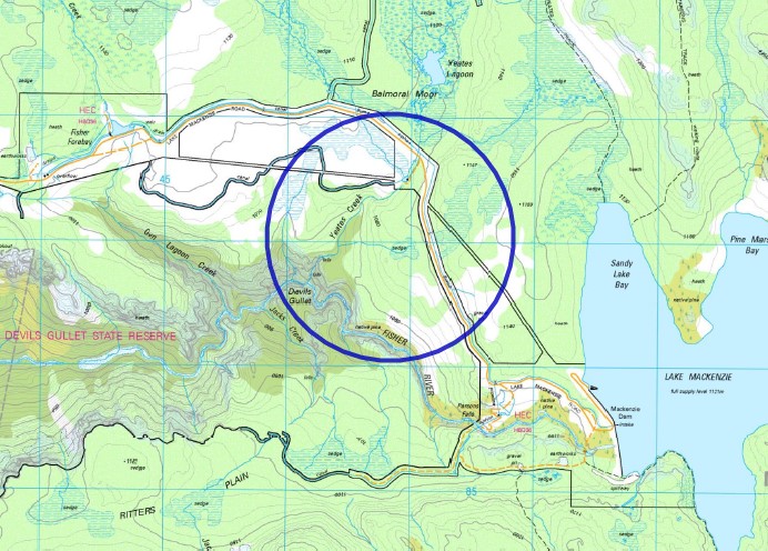
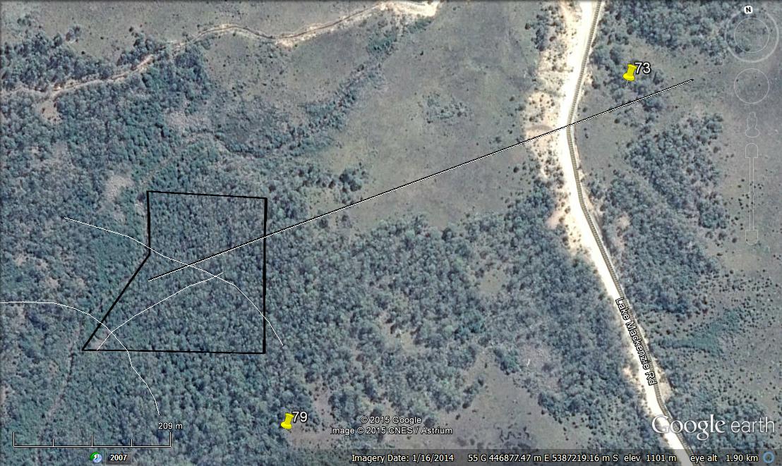
There are enough clues in Spurling’s story to work out the hut’s rough location. John Pithouse summarised it well, ‘on Balmoral Plains between Parsons’ Falls and Devil’s Gullet, close to Pine Tree Creek (also called Yeates Creek) at a point between the road and the Fisher River ravine’.7
Access from the Lake Mackenzie road would be very easy. The country isn’t too bad either. Just below the road is fairly flat. There are open grass plains near Yeates Creek that become open forest (with patches of thick scrub) further south and then a marshy area. Further downhill gets interesting. There is a rocky cliff line and then the country falls away fairly steeply through bands of thick scrub and open forest before finally reaching the escarpment above the Fisher River.
The Search
Finding the hut looked pretty straight forward. Access would be easy, the bush wasn’t too thick, there was a good photograph and it looked like a substantial hut. Ian stared at the photo for hours and got a good feeling about its location. Although a heavy layer of snow did make interpreting the surroundings a little harder. Being a log hut ‘means lots of tree and therefore plenty stumps.’8 Stumps are one of the most enduring signs of human activity in the bush and outlive many huts. The hut was probably ‘6 meters with an extra 2.5m of chimney’.9
September 2015
The weather was good enough to search. Ian made three searches that month. Occasionally he was assisted by others interested in the history of this country. We were all happy to share his enthusiasm. The high hopes disappeared quickly.
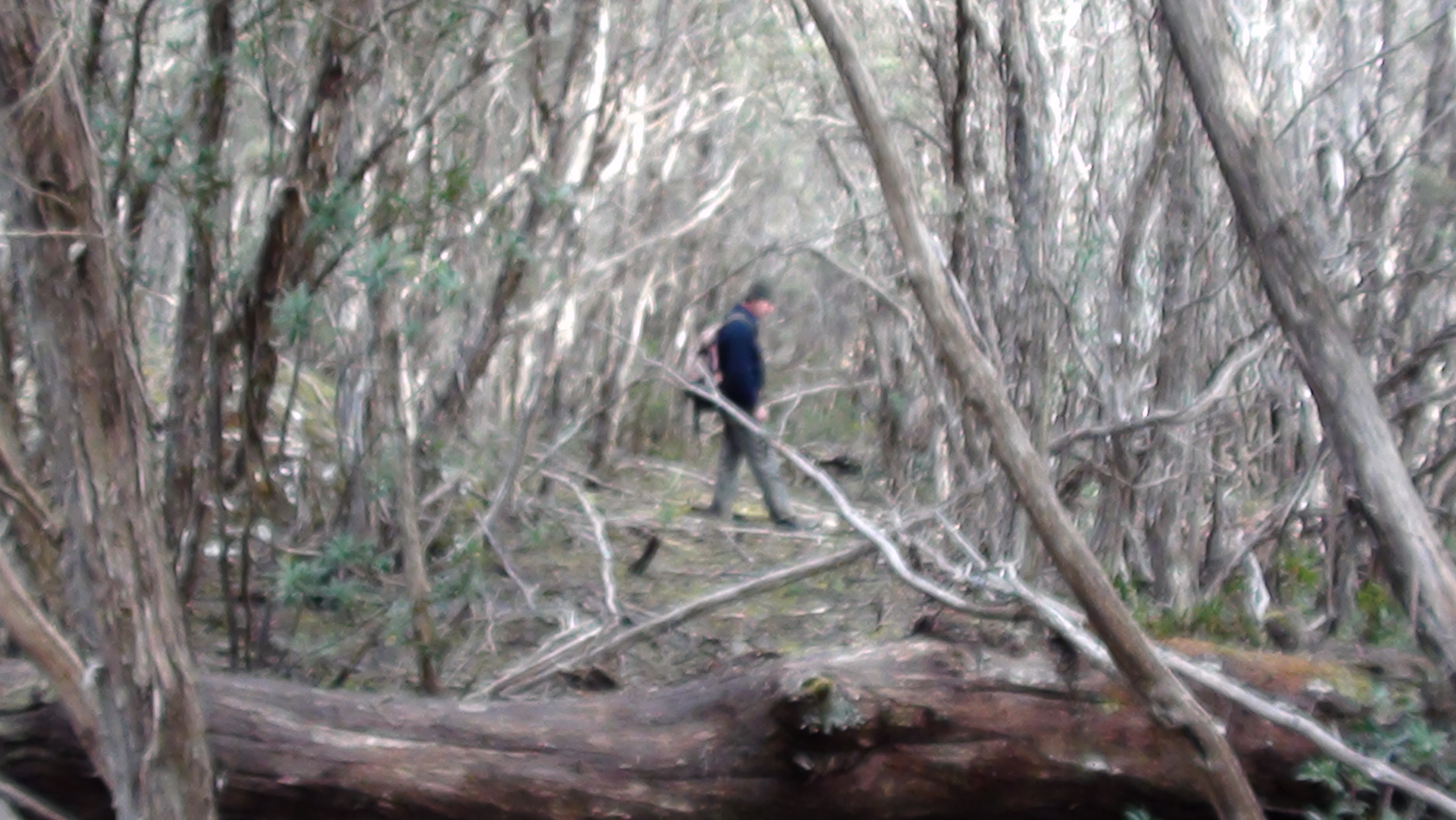
What looked easy in theory became difficult in the bush. It had thick patches and a jumbled cliff line cut that through the middle of the search area.
Nic and I followed Ian on his second trip. He guided us past a small marsh to the edge of the rocky drop. An ideal location with water nearby and reasonably level land. Within about 15 minutes were passed within 10 metres of where we ultimately found the hut site. Scrub covered everything so well and also blocked that important clue, the view of the distant ridgeline.
There weren’t any finds that day but there were plenty of teases. Sometimes our hearts would race and we thought that this could be it. There were some stumps in the forest near the road but they were too small and too new — probably fire wood for hydro works. Near Yeates Creek was some blue bailing twine in a nice spot. It had a lot going for it; near a creek, fairly level, on the edge of a forest. We were excited again but there was no sign of stumps or footings. A little later there was a lovely flat and clear spot near the edge of the rocky ridge. We hoped it was the hut site but the orientation was wrong and there were no artefacts.
We then headed over the cliff. This country was not as likely but we were getting desperate. It was too steep, but a little creek did run down the hill. Again, we thought that we had something — a track running across the hill. Did it link Parsons Falls to the hut and Balmoral Plains as mentioned in Spurling’s story? We followed it until we hit a painted marker. Later we found out it was a survey line cut by the Hydro in the 1960s.10
Ian was in the right area but the hut and its tell-tale stumps were gone, probably from a big fire in the past.11 It was going to be harder to find, may be it would just be a ‘site large enough to facilitate the hut’s foot print … and, of course, a nearby water source’.12 We scanned every nock and cranny for some rusty artefact that would give away the location of this illusive hut.
Every failed trip meant taking time to reconsider and work out a different approach. Always keeping in mind the photo, nearby water, good sized trees for the construction and an access track.
October 2015
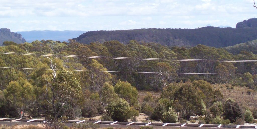
Ian made another three searches. He took photos from precisely GPSed locations and we compared the ridgeline to the one in Spurling’s photo. It had a few distinct features that changed as Ian moved around. There was one tantalising view from a ladder of the side of the water flume. It seemed to match the photo so well that we feared that the road or flume had been driven through the hut site. Ian took photos from the hill above the road, along the road and lower in the bush. Trees often blocked a good view. But we finally worked out a search zone.
Yeates Creek wrapped nearby the zone and the rocky cliff line near the zone’s eastern side. Somewhere near the marsh was the southern boundary. Ian followed Yeates Creek downstream for about a kilometre. Some more hints. Pencil pines had been felled on either side of the creek. Again disappointment, the stumps are old but ‘I am not convinced that they are 100 years.’ He also did a thorough search of the area around the blue twine. There were ‘some good looking spots’. But still nothing definite. However, the ‘maybes’ were stacking up.
Another idea was to find the tracks that led to the hut. Google Earth was a great help. We looked for features and thought that we saw tracks running through the bush. Did they date to the Parsons’ days? They were worth a search. Would they lead us to the door of the hut? We also found the location of the historic Dublin Track.
November 2015
There were only two searches and we were getting more and more desperate. Ian had worn out the search zone. He started to range over a wider area just to confirm that there wasn’t another solution. Gradually a lot of country and options were ruled out. At the end of every trip there was disappointment, followed by thinking of another angle, and then the plan for the next search. Ian wasn’t slowing down.13
December 2015
In December there was three searches following up more unlikely ideas as all the obvious ones had been ruled out. The tracks were figments of our imagination and the line of the Dublin Track was too far north.
January 2016
When 2016 started, and 11 trips into the bush, you’d think that Ian would be giving up. No. Just thinking of different ways of solving this puzzle. He picked up on Simon Cubit’s suggestion that the hut was built of pencil pine.14 Ian had already ruled out the felled pines in Yeates Creek as ‘HEC relics’. There was ‘no reason for not being below our area. Obviously, the altitude is too low for the hut site however they may of hauled the materials uphill — something we hadn’t contemplated.’
Before that could be followed up massive fires started in the area. By late January much the region, and large parts of the state, were on fire. Lake Mackenzie was badly hit. Field work would have to wait.
February 2016
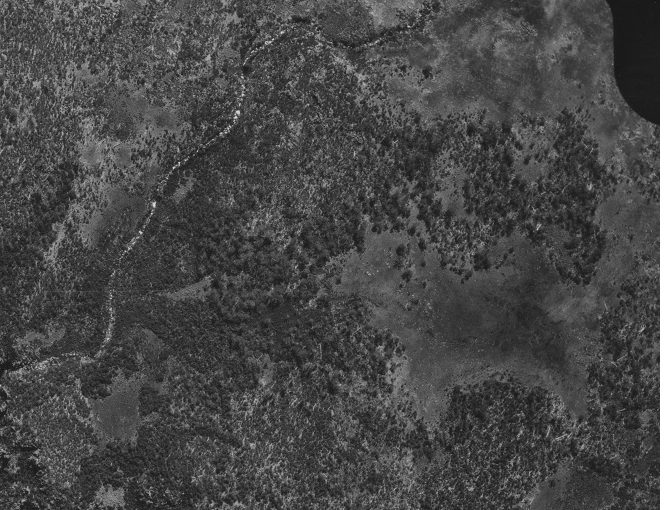
We were able to track down some aerial photographs. The earliest are taken in the late 1940s but the best we could get for this area were from January 1964, just after the 1960/61 fires. They confirmed what we already knew. The hut was gone by this time. The forest was also much more open, a sign of these fires. This meant that tracks, trees with blazes and stumps were gone. Looking for clues in the vegetation was pointless.
And we were looking for a hut that had been gone for more than 55 years.
March 2016
On 30 March 2016 Ian and I returned to the fire ravaged area. This was the one last (but never say last) search.
What we found is that the fires had burnt all leaves and most of the smaller bushes away. The country was covered by the blackened trunks of trees. It was an ugly sight but it was much easier to search.
Again we searched the target area. This time we were quick and thorough. We covered the zone. There was nothing. We were now certain of that.
There were a few possible track lines to look at. We moved out of the search zone. Then much further south to look over the gorge of the Fisher River valley. It was late in the day and again nothing was found. We started the familiar unhappy walk back uphill and towards the car. This was the normal end to our searches. Walking quietly back to the car, chatting solemnly about what we had and hadn’t found and then putting up ideas, most crazy, about what to do next.
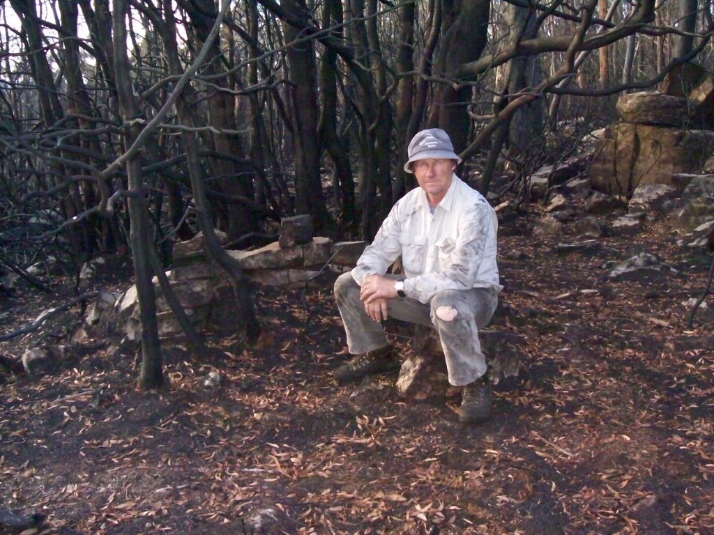
Ian wanted to look along the brow of the rocky cliff line south of our search zone. It wouldn’t take us far away from the route to the car. And then he saw a pile of stones. Far too square and stacked too neatly to be natural. We looked more closely. Simply not believing that this could be it. There was the silhouette of a hut. Rocks in a line to hold the bottom logs. We stepped out the size and checked the alignment. It seemed right. Then finally we found where the original photo was taken in 1904. We could then identify the features in the photo and see that they all lined up with our view. Standing above the hut site was the place were Stephen Spurling III had stood more than 110 years before and photographed the hut. The view fitted. The hut site had been found. But even then we were so used to disappointment that we considered every idea that would ruin our discovery. Were there other huts in the area and this wasn’t Parsons, were we just imagining that the view worked? It seemed too good to be true. We needed time to think this one through.
April 2016
Ian wanted to thank the people who had helped had a close interest in the search. On 30 April 2016, he guided John Pithouse, Tom Lawrence, Nic Haygarth, David Bye, Richard Sands, Jenny Cook, Shane Pinner and Eddie Firth to the hut site. Two of us David von Stieglitz and I couldn’t make it on the day.
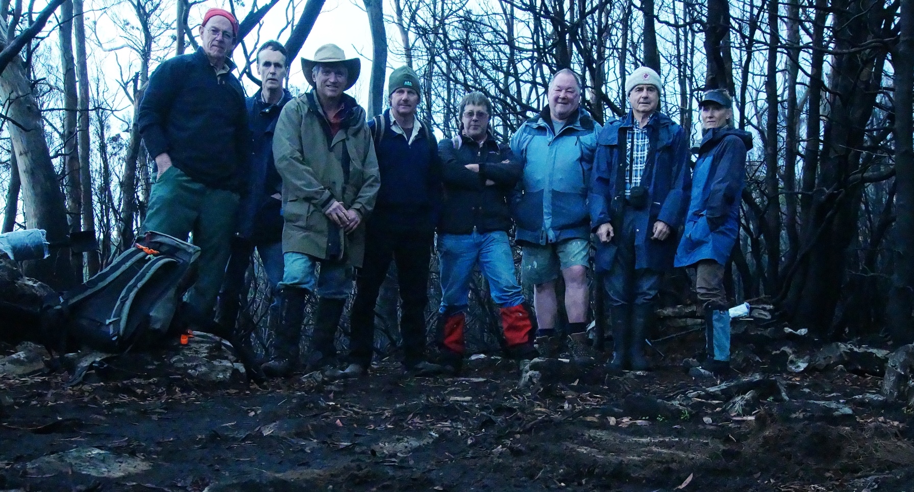
To commemorate the occasion Ian had a sketch made of the hut. The search was over.
There was one final step to take. To turn the cold rocky remains into something with a living history. Ian and David von Stieglitz measured the hut site, examined the site and also put up some poles to mock up the ridge of the hut. There were some surprises. The hut was much smaller than originally thought. It was, as Spurling described it, ‘cosy’. It was barely 3.5 metres long, without the chimney. And 2.5 metres wide. To enter the hut you would have had to stoop over. The centre of the hut was high enough to stand in but not near the walls.
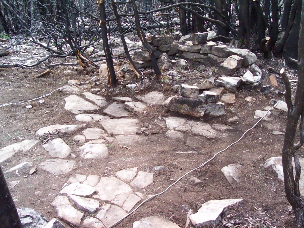
The site had a few robust pieces of burnt metal, nails and other sundry rusty bits. There was no sign of bottles, which only says that the hut was not occupied much beyond the 1930s when bottles were much more disposable. Flag stones were found peeking through the dirt. They were placed in the walking area of the hut and left a silhouette of the arrangement of its interior.
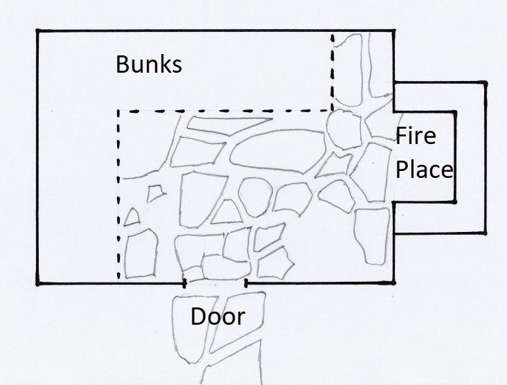
No one ever mentioned the interior of the hut but we can give you a layout of it from the stones on the floor.
The layout of the hut (I Hayes 2019)The hut was built in the 1880s or 1890s and was still standing around 1939 when Jock Norris stayed there with his father. But the oral history is silent beyond this.15 We know that whatever was left of the hut was burnt to ashes in the 1960/61 fires.
To find the hut required a lot of dedication and hard work. And by diligent examination of the few remains we can imagine a cosy hunting hut with a good fire, bunks around two walls and a rough flagstone floor. It pays to persevere.
copyright Mountainstories.net.au 2019
1 John Pithouse, Beyond the Sandstone, A Tasmanian Pioneering Story – featuring the Parsons Brothers of Caveside, Pithouse, Spreyton, 2015, page 134
2 Pithouse, page 132.
3 Simon Cubit, Mountain Stories, Echoes from the Tasmanian High Country, Volume 1, Forty Degrees South, Hobart 2016, page 199
4 Although the hunt had been on at least 27 years ago when Peter Butler put out a call for information in 1992 in the Western Tiers paper, 20 August 1992.
5 Stephen Spurling, ‘The Chudleigh Lakes in Winter’, Weekly Courier, 3 September 1904, p.14.
6 Weekly Courier, 24 September 1904, p.24.
7 Pithouse, p 132
8 Ian Hayes personal correspondence 24 June 2015
9 Ian Hayes, personal correspondence 19 September 2015
10 P Mann et al, Lake Mackenzie Power Development Scheme Seismic Surveys, Record No. 1963/150, 1962 Rec Geoscience Australia https://ecat.ga.gov.au/geonetwork/srv/eng/catalog.search;jsessionid=BD9E957220C92ED8AA318A29EBDF3643#/metadata/11233 [accessed 15 Oct 2019]
11 Probably in 1960-61, Johnson KA and Marsden-Smedley JB (2002) Fire history of the northern part of the Tasmanian Wilderness World Heritage Area and its associated regions. Papers and Proceedings of the Royal Society of Tasmania 136, 145-152.
12 Cubit, p 199
13 PB Email to Simon Cubit 20 November 2015
14 Cubit, p 198
15 Pithouse p 134
Is John Pithouse`s book Sandstone and beyond still available to buy?