Guest writer – Paula McCulloch
About four years ago I was intrigued by the story Simon Cubit wrote on his blog (then later published in his book Mountain stories: echoes from the Tasmanian high country, vol.1) about a hut near Stretcher Creek in the Walls of Jerusalem National Park. It interested me that even with help from the Deloraine Walking Club he was not able to find any sign of the hut site in the area of the Stretcher Creek where he surmised it should be. Surely there should be at least a stump or two near the area. So began my four-year search where I spent at least eight trips searching for any signs around the Stretcher Creek area.
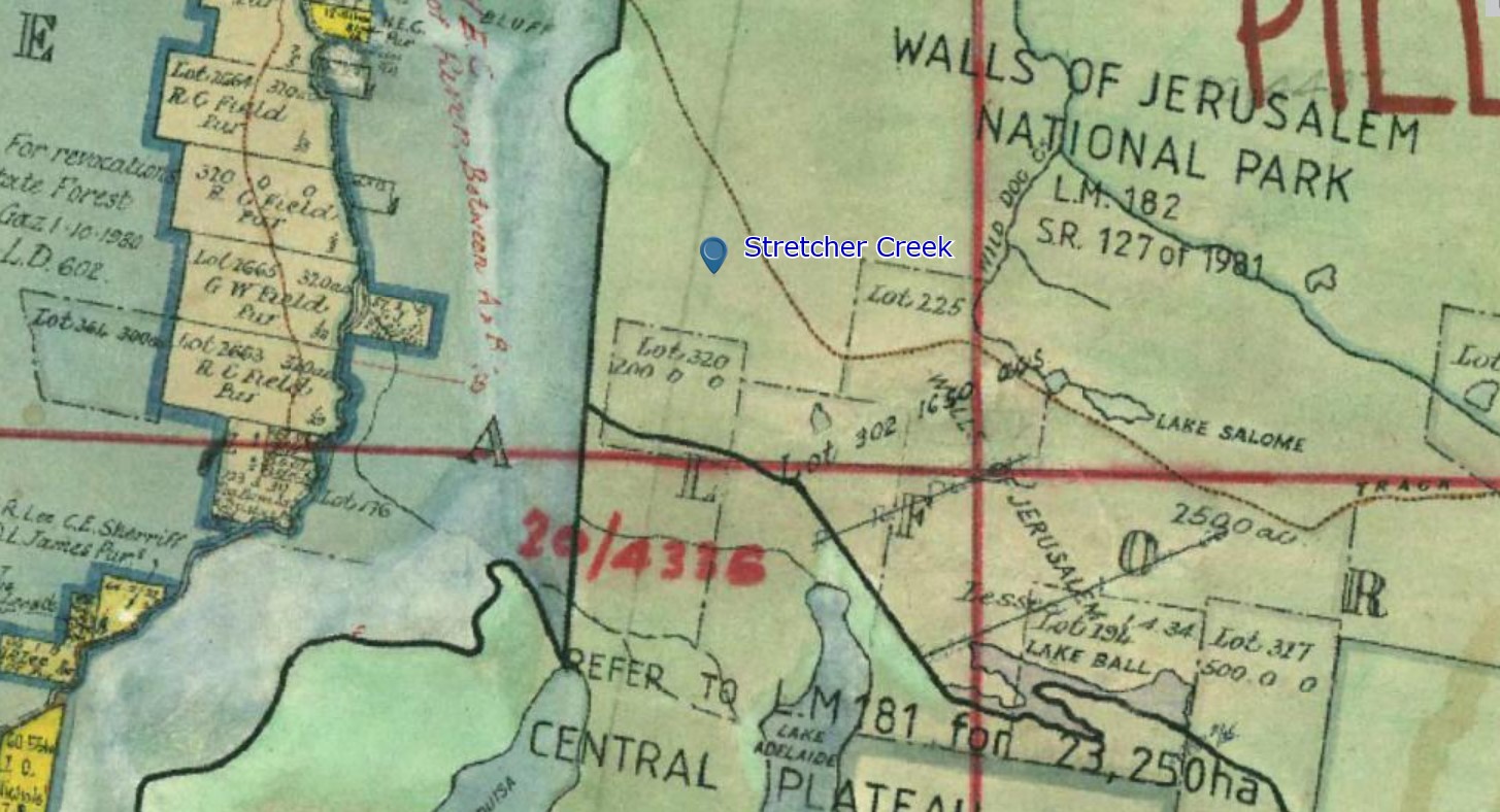
There were several clues that Simon got from interviews with local trappers who used this hut. In 1913 Richard Field leased a 200-acre block in the area and potentially a hut would have been built for the stockman Alec Burnie, caring for the stock. Keith Lee was interviewed by Simon and he stayed in a hut known as Alec Burnie’s Hut in 1923, a cold camp where you could walk a few hundred yards from the hut and look down on Howells Plains and see the fowls running in the yard down on the plains. These searches produced nothing and also didn’t quite correspond with this clue particularly. Another clue from Simon’s interviews was with Joe Hardacre was about how Stretcher Creek got its name, from an injured hunter being carried out on stretcher from this hut.
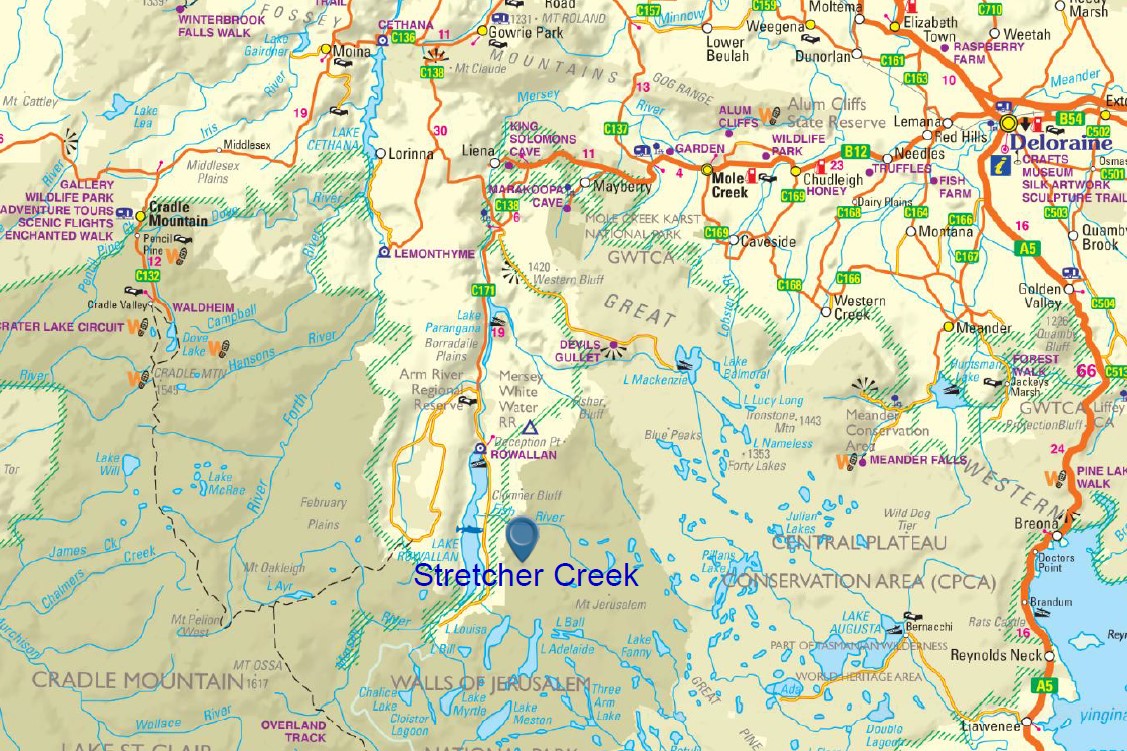
Without finding any evidence I began to look at the surrounding topography and began by wondering why Stretcher Creek was not running out of Stretcher Lake, but was an unconnected creek about a kilometre north of Stretcher Lake. Could there have been an error with the mapping and the wrong creek was named? I began to look at the area around Stretcher Lake for the right spot to look down on those chickens scratching where Lake Rowallan lies now. I thought I found the right spot west of Stretcher Lake where a nice cliff drops down over the escarpment and began another search in that area.

I first decided to explore a clearing to the south of the main ridge just south of Stretcher Lake. This looked likely as it was about 200 metres from this cliff line. So walking around this clearing with high hopes I was disappointed to find, once again, nothing. I decided to go over to the escarpment and see if I got the view I wanted and yes, there it was. I could definitely imagine those chickens.
I decided to explore the creek that runs out of Stretcher Lake, thinking of other clues in Simon’s story, but once again found nothing. About to give up, I was standing on the northern side of the creek looking across the creek up the hill opposite. Was it a tree stump or was I hallucinating? I scurried over the creek and up the hill and came to a flat area of scrub and open forest. There was not just one stump, but at least a dozen Eucalyptus stumps.
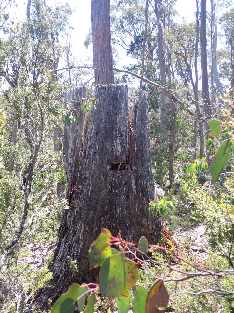
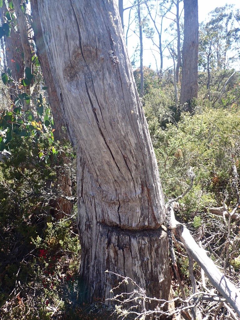
Some of which were quite large. After doing a little dance and a few cartwheels I wandered around the area. The site was exactly 200m from the escarpment, so this convinced me that I was in the right spot. Now to find the hut site. Walking around the waist-high scrub it was very hard to see anything lying on the ground. The tree stumps were spread over a large area of about 100m x 50m so there was a lot of area to search. One very large stump had a shoe mark cut into it and another tree was ringbarked but still standing.
Backwards and forwards I went through the scrub and dodging a few snakes I suddenly came across an interesting rock structure.
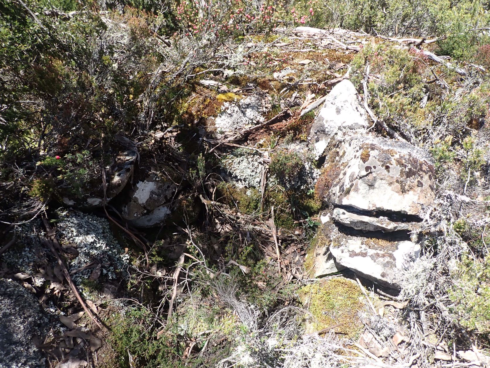
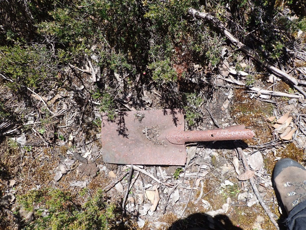
It looked like a chimney about knee high with rocks stacked up on two sides against a large boulder, but on inspection the ground in front was not flat and very rocky and sloping. There was no timber or any artefacts, so I decided that the structure may be a dog kennel. I looked about and found nothing more until I was leaving and I stepped on something metal in the scrub. It was about 20m from the structure and it was a shovel without any handle. I spent another hour searching the area, but found nothing else so decided to call it a day.
Once home I sent an email to Ian as I knew he had been looking for the same site. Between us we had three more visits to the area, but found no more relics or the hut site. Just more blazed trees and a tree with notches chopped out.
On our last visit after consulting with 1947 photo imagery of the area, we widened our search, but to no avail. The area does however correspond with Field’s 200-acre lease, so it should mean that a hut of some description was in the area. The concentration of tree stumps suggest a lot of use over a fair period of time (some stumps look older than others) and a big skin shed/hut should exist. But where?
In conclusion I think we have found the area site used in 1913-1920’s by the men interviewed by Simon Cubit, but as for the actual hut itself there is so far no sign. I intend to continue looking in the area and hope that all this effort will reveal what we are looking for.
Copyright Paula MacCulloch 2023
Paula is a tenacious hut hunter and spends almost all her spare time in the bush. She previously blogged at MountainStories.net.au about the Lake Catherine Hut. Find that blog here.
Paula
I’m pretty sure you’d be aware of the hut ruins immediately NE of L Loane just S of the join-up of the Junction & WoJ tracks?
Also that area (from L Loane down to Stretcher L) was noted by surveyor James Scott on his 1850 map as a good site for a Reserve to rest, feed & water stock coming out of the Mersey Valley in autumn en-route to Bothwell etc. That note was almost certainly after the fact – stock would already have been using the area for some time, possibly a few years, when Scott transited the area to complete his survey. Happy to give you an extract of that map if you don’t have easy access to one.
Yes Chris I am aware of the hut ruin near the junction of the Walls and Adelaide track. I think it was known as Walters Hut and built by Alistair Walters as a stockman’s Hut. I did not know that James Scott surveyed the area and wrote about the good site for a stock rest, but I did know it was in line with a stock route. Would love to have an extract of the map. And thank you for your feed back.