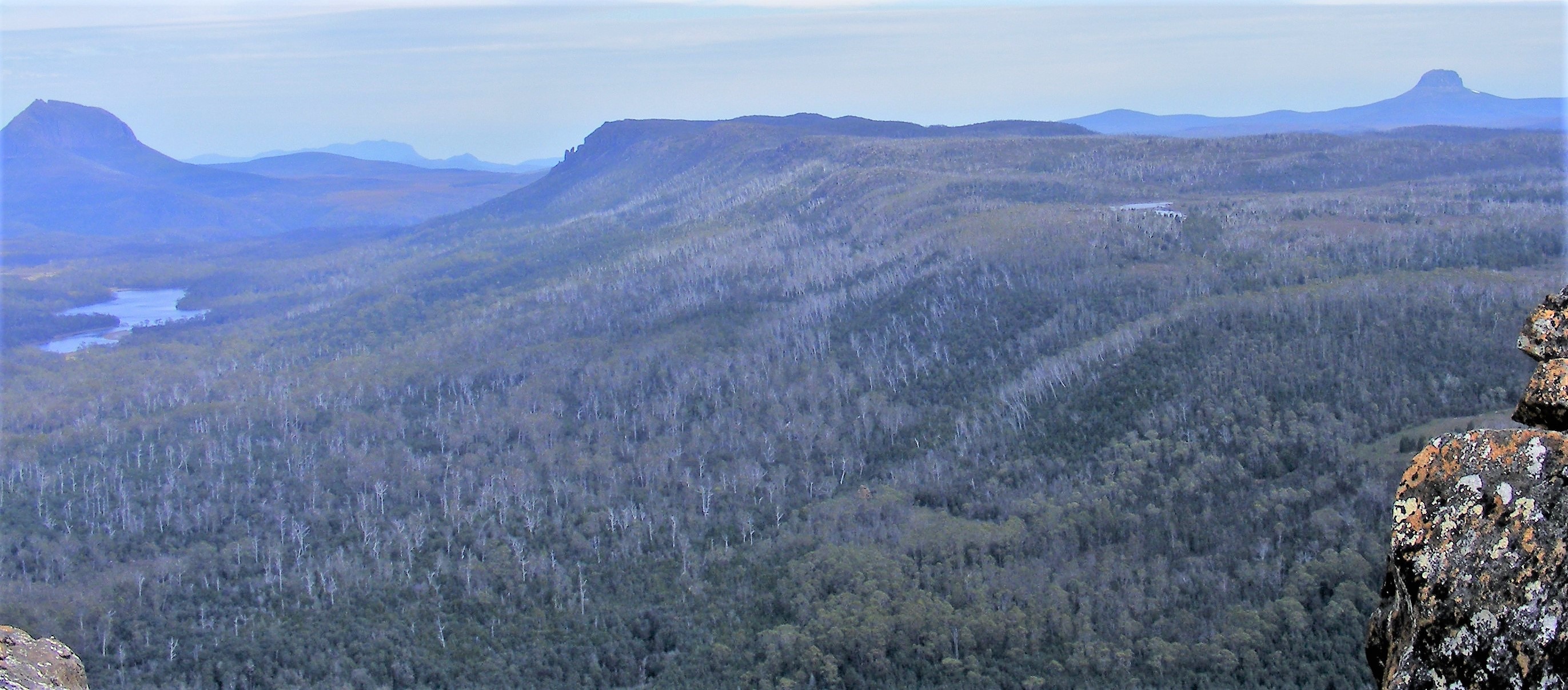
Every year hundreds of walkers follow the Arm River Track to the Pelion Plains. Most do not know the long history of the track that they use. They do not see the other old tracks that weave through the landscape and cross the modern walking route. Some may look up the valley at Wurragarra Creek and wonder what the February Plains may offer. Those few that visit them find a bounty of history and nature.
In November 2017, a group of history hunters discovered a little piece of the long story of this beautiful place – a long-abandoned and forgotten track.
The History
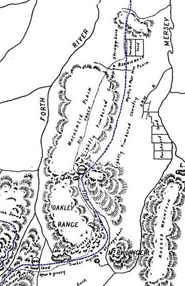
The February Plains became part of the Field cattle empire sometime before 1860 when a side-track joined them to a cattle track from Gads Hill to the upper Mersey and Arm River.[1] It was a quiet backwater until the late 1880s when the upper Mersey and Forth became part of the search for overland tracks to the new mineral fields on the West Coast.[2]
In the 1890s four new tracks were cut to the Pelion Plains and beyond. Their remains are still found here and there in the forests.
The first was in 1890 when a railway was planned from Mole Creek to Zeehan. The survey followed the Mersey River to the Pelion Plains where it was abandoned. The second track was formed by packers bringing supplies from Mole Creek who extended the cattle track across the February Plains to the Pelion Plains and shortened the supply routes.[3] The failed railway survey did bring a rush of prospectors.[4]
In October 1892, the shortcut across the February Plains was improved by the Mole Creek and Zeehan Mineral Prospecting and Exploration Company. Joseph Will, their chief prospector, ‘put on all hands to cut a new pack track from Mount Pelion to Liena’. The February Plains were marked with wooden stakes.[5] The track wasn’t new but for a while it was called Will’s Track.
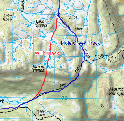
Wills Track probably followed the old side track from the Borradaile Plains. It climbed onto the western side of the February Plains and to Kings Plain at Sardine Creek. South of the Divide, a ridge halfway along the plains, it passed some small lakes and then crossed Wurragarra Creek. Then it most likely followed the railway survey packers’ short cut south west along a broad open valley that ended suddenly at the Tarn of Islands. Here the track dropped through forest to the open gullies to the east of Lake Ayr and joined the Mole Creek railway survey.
Edward George Innes, the surveyor for the Mole Creek Track, didn’t like Will’s Track. At the Tarn of Islands, his guide ‘pointed out where it disappeared over the side of the mountain’. Innes measured a descent of 80 metres within 200 metres, an almost impossibly steep grade of 1 in 2.5. The ‘clearing consisting of someone having cut away a bit of scrub here and there, leaving the logs, etc., the whole being well dotted with basalt boulders, over and around which horse and man must stumble along.[6] Innes sarcastically remarked that his sparring partner Daniel Griffin had called it a ‘well graded and well cleared pack track’.
Innes survey for the Mole Creek Track in 1896 briefly became the third track. Between the Borradaile Plains and Lake Ayr, he avoided most of Will’s track. The survey climbed onto the February Plains from the east just north of the Divide. Here it followed Will’s Prospecting Co track for a few kilometres before it followed the valley of Wurragarra Creek and then the long steady drop through forest to Lake Ayr.
When the Mole Creek Track was made in 1898/99 it often deviated from Innes’ survey line. This well made track created a second short-lived mineral rush in the Forth high country. But the track was doomed. By 1900 ‘the track … (was) blocked by scores of trees brought down by snow and wind during the winter months’.[7] The northern approaches to the February Plains were soon abandoned for the old cattle-track.
Traffic on the Mole Creek Track practically ceased when a new, much shorter track was cut across Forth River Gorge from Gad’s Hill to the Barn Bluff mine in 1902.
Between Tarn of Islands and Lake Ayr Wills track went in and out of use. It was much shorter and passed through broad open valleys that made it less prone to the timber falls that closed the Mole Creek Track. It’s only disadvantage was the steep decent to the Pelion Plains.
The mines on the Pelion Plains died but the large grassly plains got more interest when George Sloane took out a large grazing lease. In January 1910 he drove his cattle there from Lorinna. [8] By this time the route over the February Plains was a patchwork of the best parts of the old cattle track, Will’s and the Mole Creek Track.
The cattle drives over the February Plains continued until in 1916 when Lorinna was directly linked to the Pelion Plains by an extension of the Barn Bluff Track along the Forth River valley[9] The February Plains returned to being a grazing and hunting cul-de-sac.
It seems that the track past the Tarn of Islands was definitely abandoned before 1929 when pioneering bushwalkers described it as ‘rough’ and ‘overgrown’ and ‘blocked by fallen timber’.[10] This old track, first made in the early 1890s disappeared from knowledge.
The Search
In November 2017, Ian Hayes, Eddie Firth, Tom Lawrence and I walked the Arm River Track to the 100th anniversary celebrations for Old Pelion Hut. We decided to do some history sleuthing as well. One goal was to find any sign of Will’s Prospecting Co track.
It would not be easy to find a track that had no earthworks and there were only the roughest indications of where it ran. We knew that it left the Mole Creek Track near the top of Wurragarra Creek and struck it again near Lake Ayr.
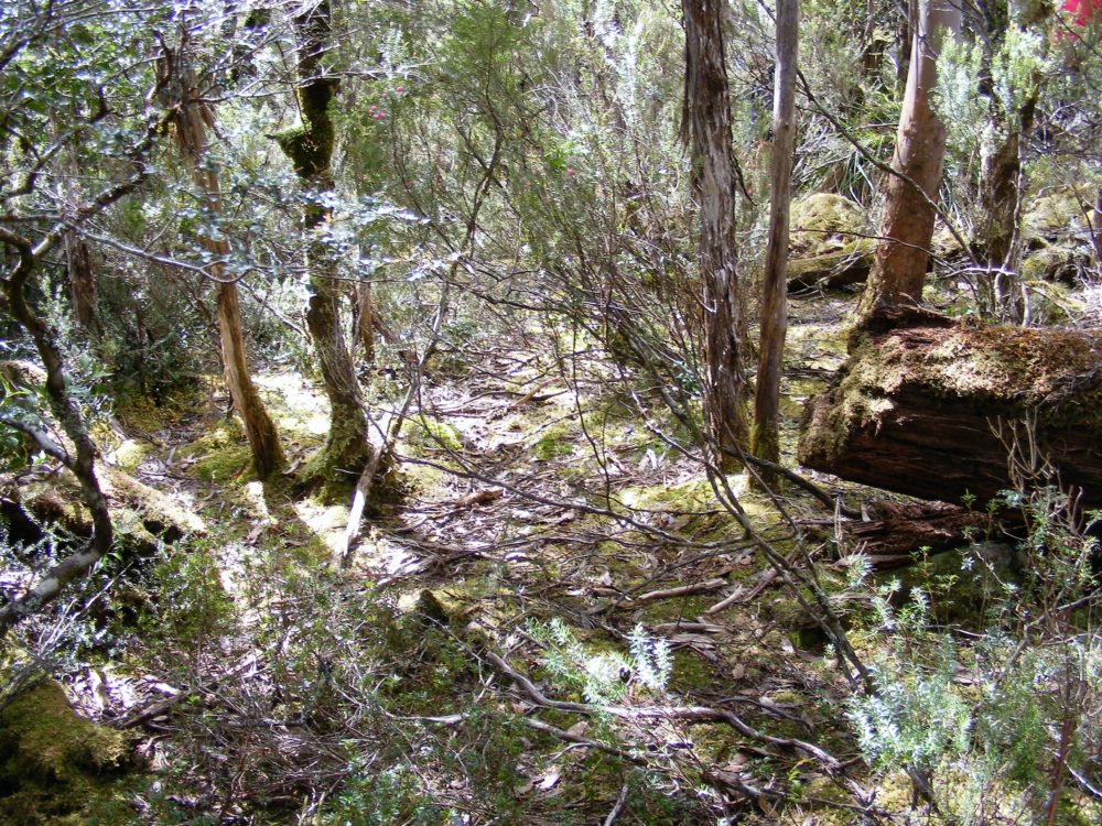
We started near McCoy’s hut site near Lake Ayr and followed a relatively open ridge that ran in the right direction. The geography, vegetation and direction all looked acceptable for a route. We did find where a gap had been cut in a fallen log.
Next was the Tarn of Islands end of the old route. This was our best bet. The tarn and then a gap between two hills made a natural pinch point where anyone would be forced into a narrow area.
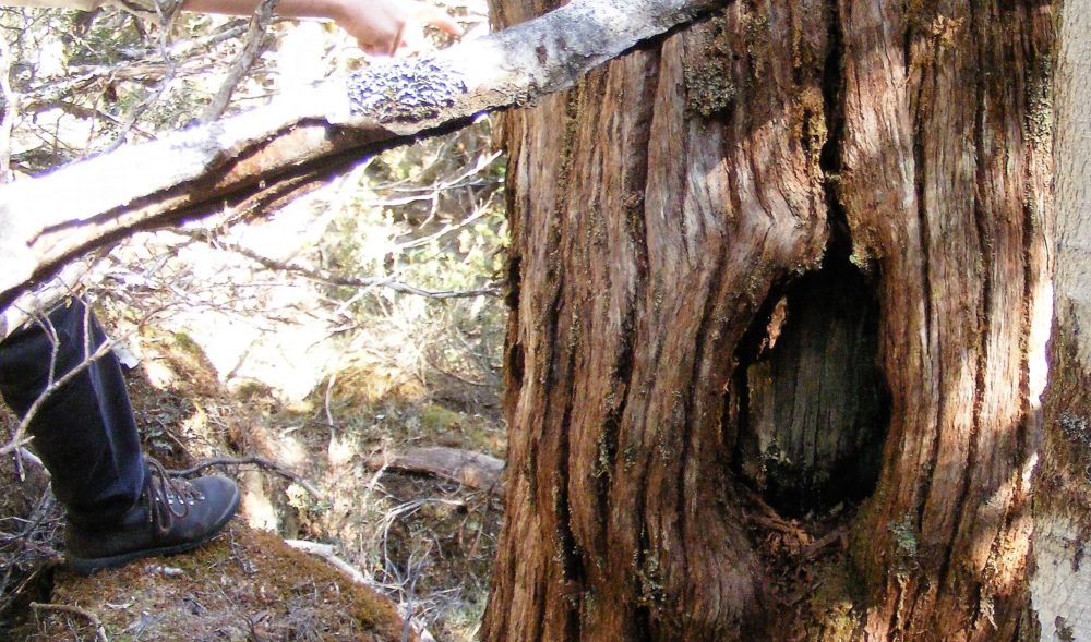
We went through the gap, over the edge of the plain and down into thick scrub. It only took a short scrabble before Ian found a series of ruts. We were able to follow them for a short distance. Old blazes on two trees beside the ruts confirmed that we had found the old track.
The overall route from Tarn of Islands to Lake Ayr was very steep at first and dotted with rocks in places but it was relatively good going and the topography was good for a route. We knew from Innes map that there had to be an old track and the landscape only allowed for this one line.
We can say that 125 years after it was opened that we had found the subtle signs of the made by the packhorses of the Mole Creek & Zeehan Mineral Prospecting and Exploration Company and of cattle driven between the Pelion Plains and February Plains. That has to be a good day in the bush.
Peter Brown
Copyright: MountainStories.net.au 2018
[1] Hobart Town Daily Mercury 24 Feb 1860
[2] Launceston Examiner, 2 Mar 1888; The Colonist, 19 May 1888
[3] Daily Telegraph, 30 June 1891
[4] The North West Standard, 24 Feb 1892
[5] Launceston Examiner, 23 Dec 1891
[6] Launceston Examiner, 12 Apr 1897
[7] Simon Cubit, The February Plains folly of Edward Innes, http://www.simoncubit.com.au/february-tracks (no longer available)
[8] Simon Cubit, The wild cattle of Pelion Plains, http://www.simoncubit.com.au/wild-cattle (no longer available)
[9] ibid
[10] F Smithies, Notes on a trip to the Pelion and Du Cane Ranges Central Tasmania, Xmas 1929. NS573/1/1