How it started
For us one search leads to another. This one started with a photo of Damper Inn on the Gordon River Track near Maydena. Ian got his teeth into that. We told that story in an earlier blog here.
This reminded me of a photo of a sign post made of number plates at the nearby junction with the Port Davey Track. So we looked for it on the same day as we visited Damper Inn. That story is here.
Now it was time for Tim Jetson’s mind to wander. He became interested in a hut on the Port Davey Track. He sent a picture of the hut to the team. This is that story.
1898 – The track and huts are made
There are a few stories about why the Port Davey Track was made. An escape route for shipwrecked sailors is one. A link to Port Davey and its few citizens is another. But it was widely reported in 1898 that it was built to encourage prospectors to find undiscovered mineral wealth in the South-West.

Anthony Bowes Kelly, a director of the Mt Lyell mine, was behind the idea. He gave £500 to build the track if other Hobart interests and the government would stump up their share.2 They did.

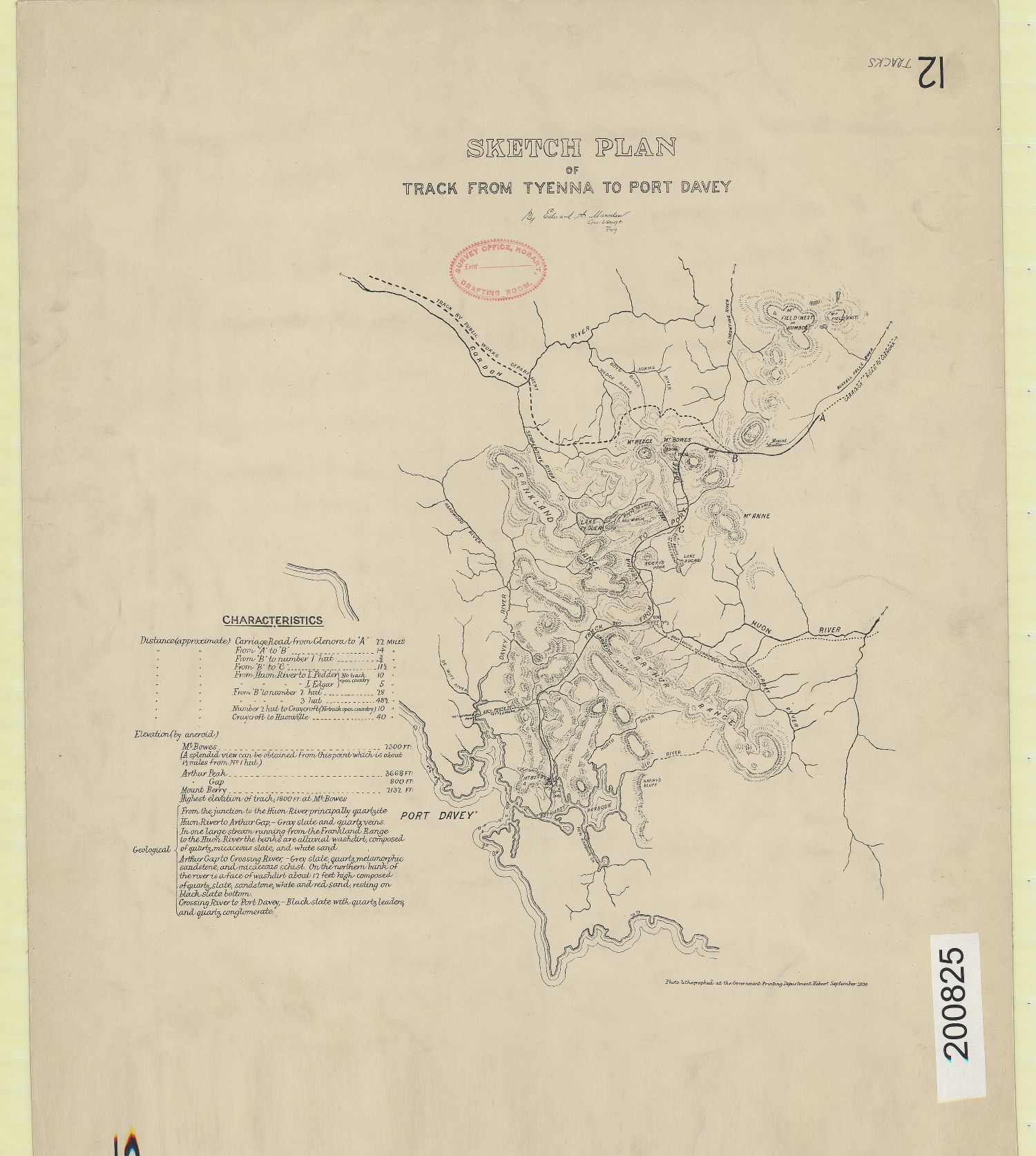
Between 15 February 1898 and 19 May 1898, Edward Marsden surveyed the route for the 80 kilometre track.4 Work cutting the track started while Marsden was still plotting it’s course. It was opened in February 1899.5
It was a very well built track. And unlike many other tracks it had excellent camps built. Three were made at convenient travelling distances for walkers.
Hut 1, 15 Mile Hut, Junction Hut, Cat Inn – make your choice
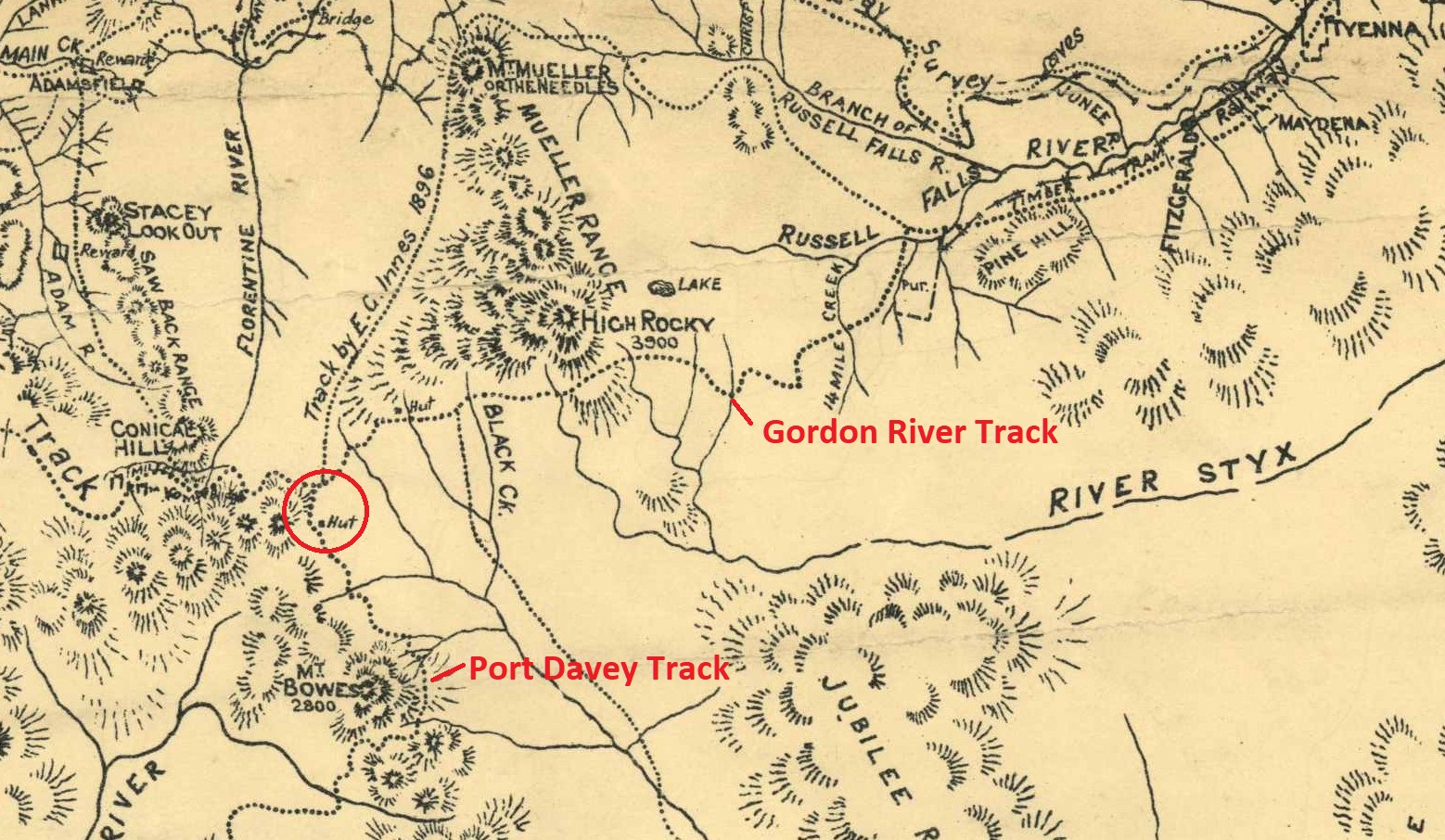
The camp that attracted Tim’s attention was called Hut 1 by Marsden. It was built in March 1898. The camp was well located and luxurious by the standards of the day. It had an accommodation hut, store and stables. The place was also referred to as the 15 mile hut, since it was that far from the Tyenna. And it was also called the Junction Hut because it was close to the junction with the Gordon Track. By 1919 it had earned the name Cat Inn ‘since wildcats get in when the occupants are out and make havoc with the food supplies’.8
Government Geologist Twelvetrees described it as a ‘very convenient resting-place for travellers’. In 1900, he said that the huts were ‘built with logs and are in good condition. The living hut is 15 feet by 12 feet, with bunks for eight men. The store hut is 10 feet by 12 feet, and is fitted with shelves for stores. There is also a three stall stable. open one side. The huts are pleasantly situated in a light belt of myrtle, peppermint, sassafras, pine, laurel, &c.. and near a good creek, one of the upper feeders of the Weld River’.10
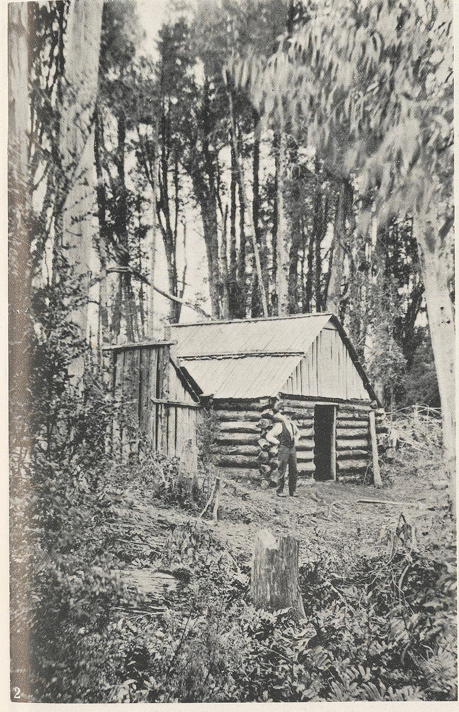
The store possibly looked like this one built in the same general area in 1890 by Thomas Frodsham.
2022 – Looking for the hut
In March of 2022, Tim, Ian and Eddie headed down the Port Davey Track from the junction with the Gordon River Track.
Tim Jetson takes up the story –
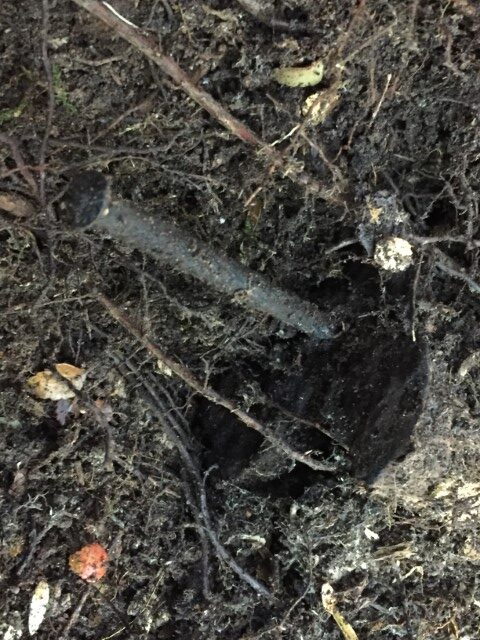
‘The Port Davey Track was taped so navigation was not an issue. In places the ti-tree was head high, at least for the three of us. Sections were corded and benched and mostly through scrub. Approaching a rise, we entered the forest and we began to notice stumps. The store hut was found without any real effort because Eddie had previously located the huts on an old 1:100,000 map. It was beside of the track as expected. Its moss covered logs revealed the shape and dimensions, 12 x 10 feet, matching Twelvetrees’ description.
We then looked around and discovered more stumps, including several bigger ones. It took a little time to locate the main hut and again it matched the expected dimensions 15 x 12 feet. Some bigger nails were still embedded in its timbers. The door way was located, as was the low fire place.
The location of the hut matched the photo perfectly and also fitted Marsden’s description of the camp as ‘on a rising bank close to a permanent stream of water’.12
We then searched unsuccessfully for the stables before calling quits and walking out. Our previous behaviour says that we’ll be back to find that one day.’

Most of the time hunting for historical remnants in the bush is just plain hard work. Occasionally we get lucky. But we make our luck too. We do plenty of research before heading into the bush and we are tuned in to find tell-tale signs, like stumps in this case. This made up for some of the difficult and unsuccessful hunts of past.
Copyright Peter Brown & Tim Jetson
1 Weekly Courier, 25 August 1910.
2 Zeehan and Dundas Herald, 12 January 1898.
3 https://adb.anu.edu.au/biography/kelly-anthony-edwin-6916 (accessed 15 Aug 2023)
4 Mt Lyell Standard, 31 August 1898.
5 Mercury, 6 February 1899.
6 R & K Gowlland, Trampled Wilderness – the history of South West Tasmania, Richmond Printers, Devonport, 3rd edition, 1986, p 140.
7 Tasmanian Archives, Track Plan No.12 – Sketch Plan of track from Tyenna to Port Davey, Edward Marsden, September 1898, Item Number: AF928/1/12
8 The World, 27 January 1919.
9 Archives Tasmania, Exploration Chart 24 – Department of Mines sketch map of South West Tasmania from D’Entrecasteaux Channel to Point Hibbs, Item Number: AF395/1/37, 1942
10 Report by MR. W. H. Twelvetrees Government Geologist, Western Explorations, Report the Journey to the Gordon River 30 June 1900, Mineral Resources Tasmania, OS252.
11 Gowlland, p 126.
12 Tasmanian News, 26 May 1898.